Project Description
South Atlantic MPAs and Deepwater Coral HAPCs: Characterization of Fish Communities, Benthic Habitat, and Benthic Macrobiota
Stacey Harter, John Reed, Stephanie Farrington, Andrew David
EXECUTIVE SUMMARY
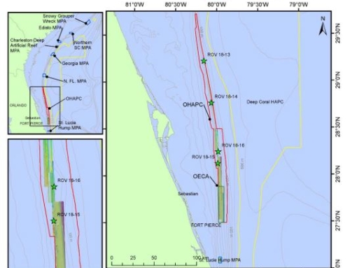
In 2009, the South Atlantic Fishery Management Council (SAFMC) established eight deepwater Marine Protected Areas (MPAs) along the outer continental shelf off the southeastern U.S. Three cruises using ROVs, CTD casts, and multibeam sonar mapping, documented and characterized the benthic habitats, benthic macrobiota, and fish populations within and adjacent to the MPA protected areas which are within the jurisdiction of the SAFMC from north Florida to North Carolina. The six MPA sites included North Florida MPA, Georgia MPA, Edisto MPA, Charleston Deep Artificial MPA, Northern South Carolina MPA, and Snowy Wreck MPA.
This report summarizes the three cruises that were conducted from 2012 to 2014 in support of this NOAA Coral Reef Conservation Program (CRCP) and SAFMC grant. These included: NOAA Ship Pisces Cruise 12-03, July 6-19, 2012; NOAA Ship Pisces 13-03, July 2-11, 2013; and NOAA Ship Nancy Foster Cruise 14-08; June 18-27, 2014. The UNCW Super Phantom ROV was used in 2012 and 2013 and the new Flower Garden Banks National Marine Sanctuary (FGBNMS) Mohawk ROV (operated by UNCW) with fiber optics umbilical and high-definition video was used in 2014. Collaborators included the Cooperative Institute for Ocean Exploration, Research, and Technology (CIOERT) at Harbor Branch Oceanographic Institute, Florida Atlantic University (HBOI-FAU), College of Charleston, and University of North Carolina at Wilmington (ROV operations).
Individual cruise reports were submitted previously (Reed et al., 2013, 2014, 2015) which provided detailed quantitative characterization of the benthic habitat, benthic macrobiota, and fish populations for each of the ROV dives conducted during each cruise.
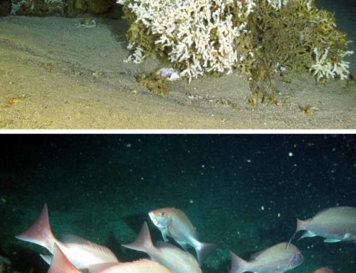
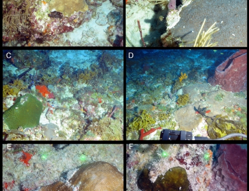
During the three cruises, a total of 98 ROV dives surveyed 37 sites within the MPAs and 61 sites on reefs adjacent to the MPAs. The total dive time was 150.9 hr during which 139.4 km of benthos were surveyed. Video imagery was collected continuously during the dives and 10,299 digital still images documented bottom habitat, macrobiota and fish. A total of 73 CTD casts were made. Thirty-three multibeam sonar surveys provided new maps covering a total area of 543.53 km2 in depths ranging from 43 to 250 m. These sites had never been surveyed previously with multibeam sonar. Georeferenced maps were made for each of the sites and were ground-truthed with the ROV dives. A total of 136 species of macrobiota were documented along with 167 species of fish.
These three cruises provide valuable data for these MPAs which may be referenced and compared to future research cruises as well as previous cruises to identify the long-term health and status of these important ecosystems. These data will be made available to the SAFMC, NOAA Fisheries, NOAA DSCRTP, NOAA CRCP, NOAA Mesophotic Reef Ecosystem Program, and NOAA Marine Sanctuaries to assist management on these habitats and key species.
Harter S, David A, Reed JK, Farrington S. 2014b. Semi-annual report. South Atlantic shelf-edge MPAs and deep-water coral HAPCs. Summary of accomplishments, Oct. 1, 2013 to March 31 2014. HBOI Technical Report No. 146. p. 4.

